Norfolk Geology
Flint & Chalk - What is it and How did it form..
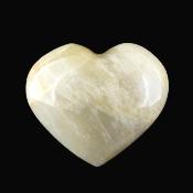
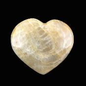
Danny Hickling - Little Gems Rock Shop.
Proud ambassador of the Deep History Coast
Flint was formed in a warm era of the Earth life - The cretaceous period around 60 - 100 million years ago - at this time due to the higher temperatures the sea level was much higher from its present level and a shadow tropical sea covered most of the earths surface. The exoskeletons of microscopic sea life mostly Coccolithophores plankton mounted up over millions of years to form a bed of chalk around 1300 feet thick (405m) over much of the UK. This chalk was laid down over a time period of over 30-35 million years. This brings up the mind boggling calculation that around 11.5cm of depth in the chalk deposit represents 10,000 years of time!
Plankton life may have well made up the largest amount of the deposits on the ocean floor but there was an abundance of other sea life life in particular Corals and Sponges-as these decomposed on the sea floor it created a kind of organic use of silica the silica rich deposits seeped through internal cracks and formed to fill voids left by extinct creatures which form and other irregularities such as shrimp and worm burrows.
In Norfolk chalk is at the surface bedrock through out most of the west of the county falling a particular type of landscape. To the East of the county the Chalk is buried but still present under glacial deposits of sand and shingle. This is because the chalk level dips gradually as we travel from west to east. This dip becomes apparent if we travel along the coast. If we start our journey Hunstanton chalk deposits can be seen at the top of the cliff above earlier red chalk. As we travel eastwards along the North Norfolk Coast we are unable to see the chalk deposit due to a lack of cliff face- However the chalk bedrock is still above sea level. The cliffs meet the sea again at Weybourne, here this chalk can be seen at the base of the cliff well above the high tide point but dipping as we move eastwards to create a wave cut platform at West Runton and lower down on the foreshore at Cromer and Overstrand.
There are also deposits of chalk which at first seem to mislead us as they can be found High above the mind deposit Sitting among glacial sands and clays these deposits of chalk Have Been lifted from thier original positionIn and dumped at higher levals - these structures are called Chalk Rafts and can be found to the East of East Runton Beach - just below Cromer Lighthouse at the top of the Cliff - at Sidestrand above the Coastguard Ramp and to the East of the Sea defences.